Walking in North Corfu |
 |
Walking in North Corfu |
|
Purchasing Walking in North Corfu
Walking in North Corfu is on sale at a price of 7.50 euros. To order, click the Buy Now button above which will take you to the payment page on the secure Paypal website where you can pay with an existing Paypal account or with your credit or debit card. After your payment is verified, you will receive the pdf copy by email. (Because sending is not
automated, you will generally receive the file within 24 hours.) THIS PRODUCT IS ONLY AVAILABLE AS AN EBOOK. NO PRINT COPIES EXIST.
Walking in North Corfu
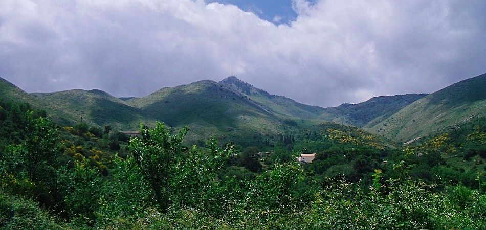
Rising to nearly 3000 feet (911 metres) straight from the sea, the Pantokrator Massif dominates Corfu's skyline. Viewed from the south, the 'twin peaks' ('korifoi' in Greek) of Mount Pantokrator and Mihalakades to its south west (852 metres), gave Corfu its westernized name. The south face of the Massif is a sheer wall of rock, with a few breaks where paths climb like staircases. To the north east, the land tumbles to the sea in a riot of gullies, whose upper reaches are linked by high tracks. Northwards, the bare limestone hills are largely free of settlement, and you can walk for miles and not see a soul. Then the land drops through deep-scored valleys and gently sloping olive groves to the lush fields and marshes of the coastal plain. To the north west, the dip slope is milder; its descent is broken by a delightful plateau where rest several untouched villages, their springs bubbling year-round with fresh water. On an island where walking is a pleasure, North Corfu is a true outdoor paradise.
North Corfu Walking Region
The North Corfu walking region extends over the entire Pantokrator Massif (apart from the narrow North East Coast strip between Barbati and Kassiopi), and incorporates the wide coastal plain of Acharavi as well as the wetlands around Lake Antinioti. Its western boundary is the Roda - Troumpetta road through Agii Douki and Xanthates. Some of the resorts and villages close to or within the area covered by this guide are Roda, Acharavi, Almiros, Agios Spiridon, Apraos/Kalamaki, Loutses, Old Perithia, Lafki, Strinilas, Spartillas, Sokraki, Episkepsi, Nimfes and Klimatia.
Links to other Corfu Walks areas
THe final sectionof the Corfu Trail wends its way through the North Corfu walking area, crossing the Massif near its highest point. In reverse, the Corfu Trail links the North Corfu area with the North West walking area at the Rekini Bridge just north of the Troumpetta Pass.
Updating Walking in North Corfu
As a buyer of the book, your name and email address will be kept on
record, and you will be sent FREE UPDATES upon request.
Maps
Unfortunately, graphics greatly increase the size of a pdf file in this format, and their inclusion would prevent dispatch by email of the document. As a result, this book does not contain maps. The best map of Corfu is Freytag and Berndt's 1:50,000 edition, though it is not 100% accurate, and it does not depict most footpaths.
Plant Lists
Flora Ionica -
An inventory of ferns and flowering plants of the Ionian Islands.
Corfu Flowers - Photographs showing many of the island's flowers, identified and named by a botanist whilst walking the Corfu Trail.